
From Soil To Harvest. Every Sample Tested, Tracked, And Trusted.
Agricultural laboratories operate at the intersection of science and food security. LIMSera equips soil, seed, fertilizer, and crop quality labs with the AI-powered automation they need to deliver accurate, timely results — at the scale that modern agriculture demands.
When Soil Data Is Wrong, Crop Recommendations Are Worthless.
Agricultural laboratories face operational pressures unlike any other testing domain. During peak seasons, sample volumes can spike tenfold in a matter of weeks. Thousands of soil cores arrive from hundreds of villages — each requiring GPS verification, proper depth documentation, crop-stage recording, and routing to the correct analytical group. A single mislabelled sample can generate a fertilizer recommendation for the wrong plot, wasting farmer resources and eroding programme credibility.
Most agricultural labs still manage this with paper registers, hand-written Soil Health Cards, and spreadsheet-based fertilizer calculations. Plot coordinates get transcribed with digit transpositions. Nutrient values are copied manually from instruments to registers to reports. Seasonal surge backlogs delay crop advisories until after the sowing window has closed.
LIMSera digitises the entire agricultural testing chain — from GPS-verified field collection through instrument-integrated analysis to AI-powered Soil Health Card generation — eliminating the manual handoffs where errors accumulate and delays compound.
Every Testing Domain Your Agricultural Lab Covers
Pre-configured for soil, seed, fertilizer, residue, and crop quality analysis — extensible to any additional matrix without development.
Soil Health Analysis
Comprehensive soil profiling across physical, chemical, and biological dimensions. LIMSera orchestrates the entire workflow — GPS-pinpointed field sampling, automated parameter assignment based on crop and region, instrument-integrated analysis, and one-click Soil Health Report generation. The AI engine correlates macro-micronutrient ratios against historical plot data, flagging fertility decline patterns that manual review would miss. Seasonal comparisons across cropping cycles reveal long-term soil degradation trends at the individual plot level.
The Agricultural Sample Journey, End To End
Survey Design & Planning
Define survey grids by village, block, or district. Set GPS-based sampling density, assign field teams to zones, and auto-generate unique survey identifiers. Seasonal calendars ensure each plot is sampled at the agronomically correct crop stage.
GPS-Verified Field Sampling
Surveyors collect soil cores using the LIMSera mobile app. Depth, moisture, crop standing, irrigation type, and site photos are recorded at the point of collection. QR-coded sample bags are linked to the plot by scanning at the GPS-verified location. Full offline operation.
Lab Receiving & Auto-Routing
A single QR scan at the laboratory populates all field data on the analyst's screen. The system verifies sample condition, assigns a lab ID, and routes to the correct section — soil chemistry, microbiology, or residue analysis — with default parameters loaded based on survey type and crop.
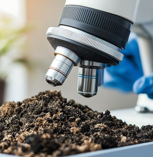
Instrument-Integrated Analysis
Results flow directly from AAS, ICP-OES, spectrophotometers, and chromatographs into LIMSera. The AI engine validates nutrient ratios, flags anomalous profiles against the plot's historical baseline, and runs automated IQC checks before results reach any reviewer.
Tiered Review & Approval
Results pass through your configured approval hierarchy with AI anomaly summaries at each tier. Reviewers see confidence scores, historical plot comparisons, and flagged inconsistencies. Accept, revert for full retest, or request specific parameter retesting — every action documented.
Soil Health Report & Distribution
The system auto-generates soil health reports with fertility ratings, nutrient gap analysis, and crop-specific fertilizer recommendations. Reports are distributed via printed QR-coded documents, farmer portal, SMS, or email — each linking to the full digital record. Configurable for any national soil health programme format.
Everything Your Agricultural Lab Needs
Ten purpose-built capabilities designed for the scale and seasonality of agricultural testing.
Offline-First Field Sampling
Mobile app captures GPS coordinates, soil depth, crop type, irrigation method, and field photos — even in areas with zero connectivity. Auto-syncs when signal returns.
Plot & Farm Registry
Permanent digital registry for every plot, farm, and survey village. Each plot carries its full testing history, crop rotation record, and soil health trajectory.
Configurable Parameter Library
Soil chemistry, seed quality, fertilizer assays, pesticide residues, and water quality — all parameter groups configurable per sample type, crop, and regulatory standard.
Direct Instrument Ingestion
AAS, ICP-OES, spectrophotometers, GC-MS, LC-MS data flows directly into LIMSera. Zero manual transcription. Automatic unit conversion and range validation.
AI Correlation & Anomaly Engine
Cross-validates nutrient ratios against agronomic norms, detects implausible profiles, predicts seasonal nutrient depletion, and auto-scores result confidence before approval.
Geospatial Fertility Mapping
Interactive district and block-level maps with fertility heatmaps, nutrient deficiency corridors, and AI-predicted intervention zones. Drill down to individual plot results.
Reagent & Instrument Lifecycle
Inventory tracking for reagents, standards, and consumables with expiry alerts. Calibration scheduling for all instruments with drift detection and predictive maintenance.
ISO 17025 & Global Accreditation
Immutable audit trail, calibration registers, measurement uncertainty propagation, CAPA workflows, and document version control — accreditation-ready for ISO/IEC 17025, NABL, A2LA, UKAS, and equivalent bodies worldwide.
Soil Health Reports & Crop Advisories
Auto-generated soil health reports with fertility ratings, fertilizer dose calculations, and crop-specific recommendations. Configurable for any national soil health programme format. QR-coded for digital verification.
Predictive Crop Intelligence
Forecast nutrient depletion, recommend pre-season amendments, detect contamination trends across regions, and generate block-level crop advisories automatically.
Every Soil Core GPS-Pinned. Every Bag QR-Linked. Zero Mix-Ups.
The LIMSera field app transforms unstructured soil collection into a repeatable, auditable process. Surveyors follow GPS-guided plot assignments. At each location, the app records collection depth, soil colour, moisture condition, standing crop, irrigation type, and a geo-tagged photograph — all before the sample bag is sealed.
A QR-coded label is generated and scanned at the plot itself, creating an unbreakable link between the physical sample and its digital record. When the team is 40 kilometres from the nearest cell tower, every reading is stored locally and synchronised in full the moment connectivity resumes.
From Raw Data To Fertility Insight. AI Validates Every Result.
Instrument readings enter LIMSera directly — AAS for micronutrients, spectrophotometer for organic carbon, flame photometer for potassium. The AI engine doesn't just check ranges. It cross-validates nutrient ratios: if nitrogen is high but organic carbon is low, that's a chemical fertilization signal without organic replenishment. If zinc is deficient in a rice-wheat plot, that's a known rotational depletion pattern. The system flags these correlations before any human reviewer sees the data.
Seasonal trend models trained on your region's data predict which plots will fall below critical nutrient thresholds next season. Fertilizer dosage recommendations are generated per crop, per soil type, per plot — not from generic lookup tables, but from the AI's understanding of that specific plot's nutrient trajectory over multiple seasons.
See Soil Health Across Blocks And Districts. Plan Interventions Before Deficiency Hits.
LIMSera's geospatial dashboard renders every sampled plot on an interactive map. Colour-coded markers indicate fertility status — green for adequate, amber for deficient, red for critically depleted. Nutrient-specific heatmap overlays reveal concentration gradients: where potassium is declining, where zinc has crossed the critical threshold, where organic carbon is trending toward infertile levels.
Machine learning models identify emerging deficiency corridors that cross village and block boundaries — patterns invisible in tabular data. AI-generated crop advisories reach the right agricultural officer at the right administrative level: a village-level worker gets plot-specific recommendations, a district officer gets a programme-level intervention summary with budget implications.

Global Accreditation Infrastructure Built In. Not Bolted On.
Tamper-Proof Audit Trail
Every action — result entry, edit, approval, rejection — is timestamped, user-attributed, and permanently recorded. AI flags anomalous patterns for quality review.
Instrument Calibration
Centralised calibration register for AAS, ICP-OES, spectrophotometers, and chromatographs. AI-assisted scheduling based on usage frequency and historical drift.
CAPA & Corrective Actions
Structured workflows for root cause analysis, corrective action implementation, effectiveness verification, and formal closure. AI identifies recurring non-conformance patterns.
Measurement Uncertainty
Uncertainty budgets maintained per test method. Propagated through calculation chains and reported on soil health reports and test certificates per ISO/IEC 17025 requirements.
Standards We Support
Designed For Every Role In The Agricultural Testing Ecosystem
GPS-guided collection app with offline sync, depth markers, photo capture, and QR-coded bag linking at every plot
Pre-loaded parameter sets per survey type, direct instrument data ingestion, automated IQC, and AI-assisted range checks
AI anomaly review dashboards, cross-season nutrient trend analysis, and fertility trajectory modelling per plot
Seasonal surge forecasting, analyst workload balancing, throughput KPIs, and ISO 17025 audit readiness dashboards
Regional fertility maps, crop advisory generation, programme MIS reporting, and soil health programme compliance tracking
Self-service portal for soil health report access, fertilizer recommendations, and plot-level testing history
Frequently Asked Questions
Ready To Transform Your Agricultural Laboratory?
See LIMSera configured for your sample types, your parameters, your crops, and your compliance requirements — in a live walkthrough.
A live walkthrough configured for your laboratory. No generic demos.